População


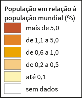
Este mapa apresenta o percentual da população estimada total de cada país em relação à população total mundial.
Fonte: TOTAL population (both sexes combined), 2020. In: UNITED NATIONS. Population Division. World Population Prospects 2019. New York, 2019. Disponível em: https://population.un.org/wpp/Download/. Acesso em: out. 2021. Elaborado pelo IBGE.


Este mapa apresenta o percentual da população estimada residente em áreas urbanas em relação à população total de cada país.
Fonte: URBAN and rural populations. Percentage of population at mid-year residing in urban areas, 2020. In: UNITED NATIONS. Population Division. World Urbanization Prospects 2018. New York, 2018. Disponível em: https://population.un.org/wup/Download/. Acesso em: out. 2021. Elaborado pelo IBGE.


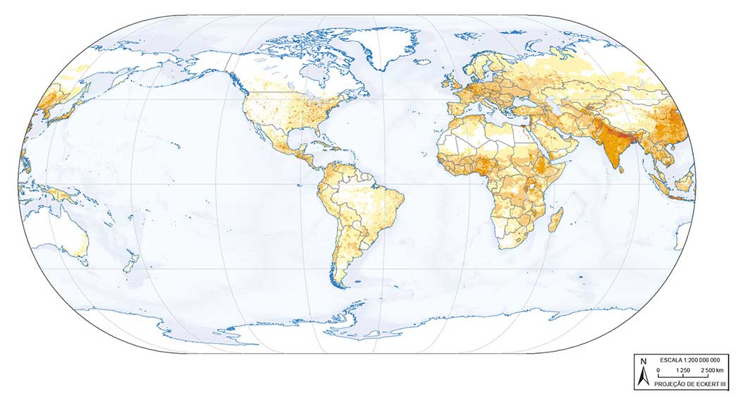
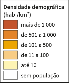
Densidade demográfica é a razão entre a população total (habitantes) e a superfície (área) em que esta população habita. O mapa apresenta a distribuição espacial da densidade demográfica por quilômetro quadrado da superfície terrestre.
Fonte: CENTER FOR INTERNATIONAL EARTH SCIENCE INFORMATION NETWORK. Gridded Population of the World, Version 4 (GPWv4): Population Density Adjusted to Match 2015 Revision UN WPP Country Totals, Revision 11. Columbia: Ciesin; Orangetown: NASA Socioeconomic Data and Applications Center - Sedac, 2018. Disponível em: https://doi.org/10.7927/H4F47M65. Acesso em: nov. 2021. Densidade demográfica projetada para 2020. Elaborado pelo IBGE.
Fonte: TOTAL population (both sexes combined), 2020. In: UNITED NATIONS. Population Division. World Population Prospects 2019. New York, 2019. Disponível em: https://population.un.org/wpp/Download/. Acesso em: out. 2021.
Fonte: URBAN agglomerations. The 30 largest urban agglomerations ranked by population size at each point in time, 1950-2035. In: UNITED NATIONS. Department of Economic and Social Affairs. Population Division. World Urbanization Prospects 2018. New York, 2018. Disponível em: https://population.un.org/wup/Download/. Acesso em: out. 2021.
Fonte: POPULATION density by region, subregion and country, 1950-2100 (persons per square km), 2020. In: UNITED NATIONS. Population Division. World Population Prospects 2019. New York, 2019. Disponível em: https://population.un.org/wpp/Download/Files/5_Archive/WPP2019-Excel-files.zip. Acesso em: out. 2021.


